How to Read a Flood Elevation Survey for Insurance Purposes
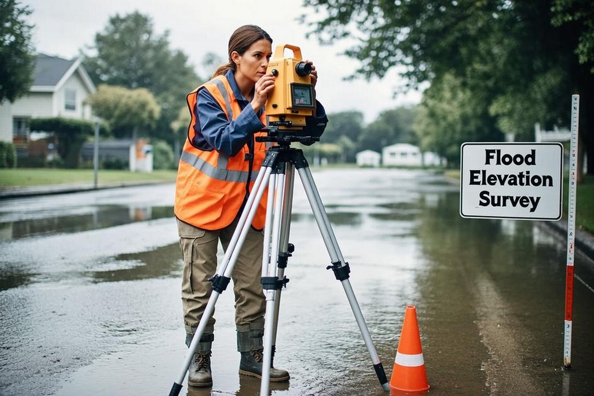
Floods are one of the most common natural disasters in the United States, causing billions of dollars in damage each year. Homeowners, particularly those in flood-prone areas, are often required to purchase flood insurance to protect against these potential losses. However, securing the right insurance coverage involves more than simply choosing a policy. Understanding how to read a flood elevation survey is critical to ensuring that your property is accurately evaluated and adequately protected. Essential inquiries into insurance matters often begin with reputable resources, such as Riverside Land Surveying. Besides being a trusted provider of land surveys in Wausau, they offer a variety of essential surveying services for residents that might reside in a floodplain.
Flood elevation surveys can be daunting to understand, especially for those unfamiliar with land survey terminology and procedures. These surveys play a pivotal role in determining insurance premiums and, ultimately, the financial security of a homeowner when facing flood damage. In this blog post, we will walk you through the essentials of reading a flood elevation survey, enabling you to interpret this critical piece of information with confidence. From explaining the key components to highlighting common mistakes, we will provide you with the insights you need to make informed decisions about your flood insurance.
Understanding the Basics of a Flood Elevation Survey
A flood elevation survey assesses a property's risk of flooding by evaluating its elevation in comparison to potential floodwaters. This assessment is crucial for insurance companies and homeowners alike as it helps to predict the likelihood and potential impact of flooding, which directly influences insurance rates. The information derived from flood elevation surveys can guide homeowners in making informed decisions about purchasing flood insurance and implementing protective measures.
Key Components of a Flood Elevation Survey
When reviewing a flood elevation survey, certain key components require your attention. These elements provide the necessary data for understanding your property's flood risk:
Base Flood Elevation (BFE): This is the computed elevation to which floodwater is anticipated to rise during a base flood event, typically a flood with a one percent chance of being equaled or exceeded in any given year. The BFE acts as a benchmark for insurance requirements and risk assessments.
Elevation Certificate: This document, provided by a licensed land surveyor or engineer, verifies the elevation data for a specific property. It includes crucial details such as the lowest floor elevation, which is essential for determining insurance rates.
Flood Zones: Identifying whether your property is in a designated flood zone is part of the flood elevation survey. Flood zones, as defined by the Federal Emergency Management Agency (FEMA), determine the level of risk and are a major factor in insurance considerations.
Datum Points: Survey datum is a reference point for elevations to ensure that measurements are consistent across surveys. The National Geodetic Vertical Datum of 1929 (NGVD 29) and the North American Vertical Datum of 1988 (NAVD 88) are most commonly used. Identifying which datum your survey uses is essential for accuracy.
How to Interpret Your Survey for Insurance
Understanding how to accurately read a flood elevation survey is indispensable when it comes to assessing potential flood damage and obtaining the right insurance coverage. By interpreting the data correctly, you can work with insurance providers to ensure optimal premiums and coverage levels.
Reviewing the Elevations: Look at the elevation of the lowest floor of the building in comparison to the BFE. Properties with their lowest point below the BFE are at greater risk for flooding and may face higher insurance rates.
Analyzing Flood Zones: Understanding the flood zone designation on your survey can help guide insurance requirements. Properties located in higher-risk flood zones might be mandated to have flood insurance as per federal guidelines.
Verification of Documents: Ensure that your elevation certificate is up-to-date and that all survey data match current FEMA guidelines. Discrepancies in this information can lead to miscalculations in insurance rate determinations.
Requesting Professional Assistance: Consider enlisting expert help from companies like Riverside Land Surveying, which offer specialized flood plain surveys in Wausau. Experienced professionals can confirm the accuracy of critical data and provide additional insights.
Protecting Your Property with Effective Measures
To further safeguard your property, understanding how to read a flood elevation survey is just the beginning. Implementing effective measures can mitigate flooding risks and potentially lead to favorable insurance premiums.
Possible Preventative Solutions:
Elevation Improvements: Raising the lowest floor level above the BFE can significantly reduce flood damage risk.
Floodproofing: This includes sealing walls or using flood-resistant materials for properties that cannot be elevated.
Landscaping Adjustments: Directing water away from the property can help manage and reduce flooding risk.
Community Resources: Engage with local resources for possible grants or financial aid to execute mitigation measures.
Leveraging Expert Guidance in Wausau
Partnering with experienced professionals in flood elevation surveying provides invaluable support in determining your property's risk and insurance needs. Riverside Land Surveying specializes in such services, offering flood elevation assessments alongside land planning and boundary surveys to homeowners in the Wausau area and beyond. By opting for reliable surveying services, you gain not only precise data but also the peace of mind that comes with professional accuracy.
Why Choose Riverside Land Surveying?
Comprehensive Expertise: With years of experience in flood plain surveys and other specialized services, Riverside Land Surveying ensures detail and precision in all their assessments.
Community Understanding: Possessing a local understanding of Wausau and its surrounding areas, their insights are tailored to the specific needs of the community.
Commitment to Quality: Prioritizing accuracy and thoroughness, their knowledgeable team provides actionable recommendations to enhance your property's flood protection.
When reading a flood elevation survey, it is crucial to blend personal understanding with professional consultation. With their expertise in construction staking in other nearby localities, Riverside Land Surveying serves as a stalwart ally in protecting both your property and your peace of mind. Contact Riverside Land Surveying.