What Is Base Flood Elevation and Why Does It Matter?
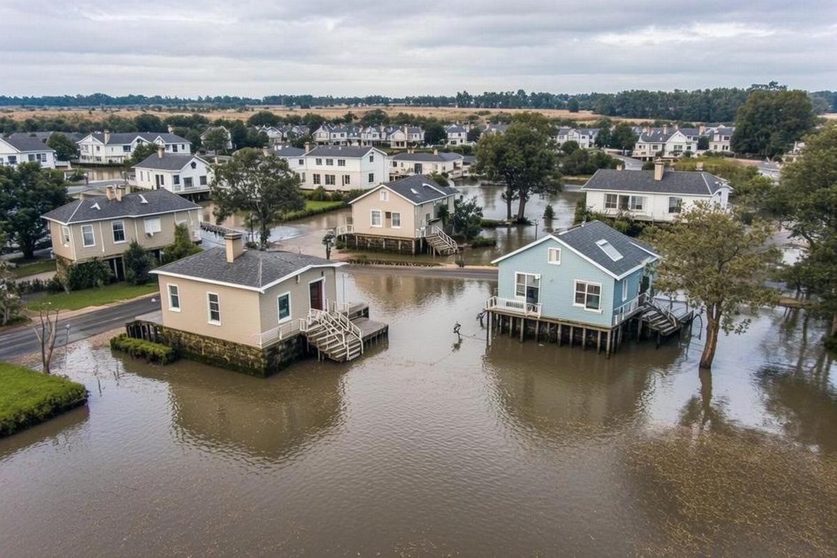
In recent years, natural disasters have become increasingly prevalent, raising concerns for those living in flood-prone areas. Understanding flood risks is crucial when planning construction or remodeling projects, safeguarding properties, and ensuring the safety of residents. A key element in flood risk assessment is the Base Flood Elevation (BFE), a term many Wausau residents might not be familiar with yet is extremely pertinent to the security of their communities. What is Base Flood Elevation, and why does it matter? At its core, the BFE refers to the computed elevation to which floodwater is anticipated to rise during a base flood. This figure, particularly vital for land surveys in Wausau, plays a significant role in determining building codes and insurance requirements, directly impacting land use and property value.
When considering a new building project, especially in flood zones, land surveys in Wausau become integral to understanding the terrain. These surveys help identify the BFE and inform municipal decisions concerning developments and modifications. Choosing Riverside Land Surveying for your flood evaluation needs ensures that you receive precise and actionable data for future construction projects.
Why Base Flood Elevation Is Essential
An understanding of Base Flood Elevation is foundational to managing flood risks effectively. The BFE is utilized by engineers, architects, and city planners to design flood-resistant infrastructures. It forms a baseline for creating zoning regulations which restrict developments in high-risk flood areas, thereby mitigating potential damage. Communities like Wausau that are affected by periodic flooding need to integrate BFE into their urban planning to ensure infrastructure resilience.
The BFE is also crucial for insurance purposes. The Federal Emergency Management Agency (FEMA) mandates that homes within designated flood zones possess flood insurance that reflects this elevation. The risk assessment and insurance rates are critically dependent on the BFE, making it evident why correct and precise measurements are non-negotiable. The collaboration between insurance companies and land surveying services, such as flood plain surveys, can provide relief and protection for homeowners in risk-prone areas.
Calculation and Determination of BFE
The process of calculating the Base Flood Elevation involves detailed analysis and a combination of historical data review, hydrologic studies, and topographic assessments. The goal is to predict the level that floodwaters might reach during a base flood, which is typically designated as a flood that has a 1% chance of being equaled or exceeded in any given year, also known as the 100-year flood.
Topographical maps and hydraulic analysis contribute to forming an accurate BFE. The evaluation of flood plain surveys conducted by experts in Wausau helps tailor this information to the local geography, ensuring that the flood maps are reliable. The collaboration with Riverside Land Surveying can result in unparalleled insights, especially when incorporating cutting-edge technologies like Geographic Information Systems (GIS) and LiDAR for precision assessment.
Regulatory Compliance and BFE
Local governments base zoning laws and building codes on BFE data to prevent catastrophic flooding impacts. For construction companies and civil engineers, adhering to these regulations is vital to avoid legal and financial repercussions. Buildings situated below the BFE are often required to incorporate mitigation measures such as flood-proofing or elevation adjustments to ensure compliance with safety standards.
The repercussions are not just limited to residential buildings. Commercial and industrial properties near flood-prone areas also need to comply with stringent guidelines based on BFE. Ignoring these rules can affect business operations and insurers’ willingness to underwrite policies, thereby elevating costs significantly. Incorporating services like construction staking, Riverside Land Surveying provides can ensure that projects meet all regulatory requirements seamlessly.
Challenges in Implementing BFE Standards
Executing plans that adhere to BFE can present challenges, especially for pre-existing structures or communities built before these standards were enforced. Retrofitting older buildings to meet BFE guidelines can be resource-intensive, but it often provides essential protection against potential flood damage.
Moreover, obtaining reliable BFE data requires considerable surveying and collaboration with environmental agencies. This aspect demands logistical coordination, especially when dealing with extensive river basins or coastal regions. Companies offering drone services in Wausau, like Riverside Land Surveying, can simplify this process by providing highly detailed aerial surveys that minimize on-ground challenges, ensuring data accuracy.
The Future of BFE in Flood Mitigation
As climate patterns become more unpredictable and cities expand into outer areas, understanding and adhering to BFE will become increasingly essential. Communities need to develop more sophisticated flood management strategies, integrating technological advancements in analytics and materials engineering to withstand adverse weather impacts.
Continued investment in advanced surveying methods, such as drone services, ensures that BFE assessments remain current and precise. Modern technologies provide a broader perspective, improving both the speed and reliability of flood management systems. For Wausau and similar cities, enhancing these frameworks means building towards more resilient environments.
Embracing Accurate BFE Assessments
As flood risks escalate with changing climates, understanding what is Base Flood Elevation and its relevance becomes increasingly crucial for homeowners, developers, and policy-makers. By leveraging precise flood plain surveys and adhering to consistent land planning based on BFE insights, residents of Wausau can secure their investments and develop safer living spaces.
For those involved in construction and land development, adhering to BFE standards is not only a regulatory necessity but a prudent approach to sustainable building practices. Riverside Land Surveying stands ready to support these endeavors with top-notch services in flood plain surveys and land planning in Wausau, enhancing future property developments and urban resilience. Contact us today to ensure your projects are both innovative and compliant with modern flood safety protocols.